Bharat Forecast System (BharatFS)
-
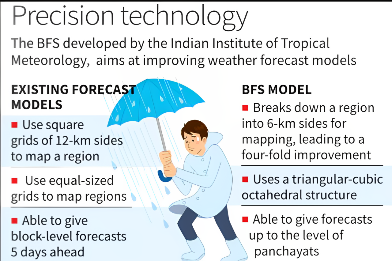
What it is: India’s indigenous high-resolution global weather prediction model designed for real-time forecasts at the cluster of panchayats level, improving extreme weather prediction.
-
Technology: Uses Triangular Cubic Octahedral (TCo) dynamical grid with 6 km horizontal resolution – better than the earlier GFS T1534 (~12 km) and most global models (9–14 km).
-
Supercomputing Support: Powered by Arka (IITM-Pune) and Arunika (NCMRWF-Noida), reducing runtime from ~12 hours to 3–6 hours.
-
Performance:
-
30% higher accuracy in forecasting extreme rainfall over core monsoon regions.
-
Significantly improved rainfall prediction in research trials.
-
-
Applications:
-
Localised weather forecasts for farmers (crop planning, irrigation, harvesting).
-
Support for water authorities in reservoir management and flood prevention.
-
Faster and more targeted disaster response.
-
-
Strategic Importance:
-
Designed for Indian geography (Himalayas, Western Ghats).
-
Developed by IITM-Pune, NCMRWF-Noida, and IMD under the Ministry of Earth Sciences.
-
Strengthens regional leadership, supports neighbouring countries, and furthers Atmanirbhar Bharat and Make in India goals.
-